
About | Third Ring Road | Timeline | District List | Village List | Environmental Report | Real Estate | Features | Current Status | FAQs
Will Bangalore Peripheral Ring Road open new roads and opportunities for the people?
Bangalore- the technology hub and one of the most crowded cities in India, ranks as one of the best cities to live and work in. The growth rate for this country is far better than in other cities. According to recent reports, Bangalore’s geographical extent has increased by nearly 2200 SqKm, and more than 80 lakh vehicle count was reported in the town.
Bangalore is continually inviting and attracting the interests of people from the outskirts. But insufficient infrastructure system is one of the city’s most significant drawbacks, leading to congestion and traffic at several locations. Thereby Government of Bangalore is planning to improve the existing demographic infrastructure of the town, and Bangalore Peripheral Ring Road is one of the most significant projects to facilitate and smoothen the transportation congestion.
Spread over 2400 acres of land, the 73 km circular road project by Bangalore Development Authority (BDA) has been in planning for decades, covering all the city’s peripheral areas.
Also, read about the top 10 upcoming expressways of India: Future of Roads!
Details about Bangalore Peripheral Ring Road
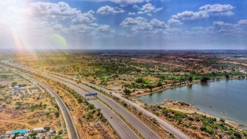
PRR Bangalore is a nearly 73-74km circular; 8-lane (100 meters wide) and four service lane project that will connect and cover the areas from Anekal, East, and North Bangalore. Starting from NICE Junction, Tumkur Road, it will connect through Bellary Road, Old Madras Road and stop at NH 44, Hosur Road.
| Total Estimated Cost of the Project | Rs. 21,091 Crore |
| Length for the Project | Around 73.50 Km |
| Width for Lanes | 3.5m |
| Total Lanes | 8 (4+4) Lanes and 6 (3+3) Service lanes |
| RoW | 100 m |
| Status | Underbidding |
| Design Speed | 100 Kmph |
| Completion Deadline | December 2027 |
| Project Model | Under Public-private partnership, Build, Finance, Design, Operate Model (PPP-DBFOT) |
| Owner for the Project | BDA (Bangalore Development Authority) |
This mega road project will encircle all the city’s peripheral areas, making connectivity more accessible and improving the realty landscape of the city. According to the official reports by Government, around 2400 acres of land have been acquired for the project, and it will further be executed from a private-public partnership transfer model through design-build-finance.
Developers for the road will have the advantage of charging around Rs. 50/- from each vehicle as a toll amount to recover the profit or cost and meet the funding target. After its completion, 17 toll plazas will be introduced to the road along with two clover field junctions at Airport Road and Old Madras Road.
The circular path will have nine exit and entry points, four underpasses, five flyovers and five ROB (Railway Overbridge).
Which needs with the Third Ring Road will fulfil?
Presently, Bangalore already has two ring roads. The internal path links from Koramangala to Indiranagar, and the outer ring road connects all the highways and converge into Bangalore. ORR (Outer Ring Road) includes five state and five national highways and is 60km long. The connections for ORR include-
- Bannerghatta Road
- Mysore Road
- Tumkur Road
- Kanakpura Road
- Magadi Road and many others.
The government has recently published a report that more than 1000 vehicles cross over and use the Outer ring road, which also boosted the real estate around the ring. But, the new constructional phase for Kempegowda International Airport has increased traffic congestion, burden and concentration on the existing inner and outer rings.
Therefore, the new peripheral road will help reduce the traffic pressure from the existing streets, providing unique interest to policymakers and real estate developers.
Bangalore Peripheral Ring Road Timeline
| Years | Constructional Status |
| 2005-2006 | Mooted by the Opted Government |
| 2006-2010 | Roadblocks in the land acquisition process and landowners were not ready to provide their land and approached courts. |
| 2011 | Project cancelled due to unexpected delays. |
| 2011-2014 | Length revised to 65 kms, court permit for land acquisition, stuck under government clearance phase. |
| 2014-2015 | Fetched environmental clearance and a green light for the project. |
After all these delays and procedures, the Supreme court finally gave its nod to all the requests related to land acquisition. It allowed them to retain the original length (75 km), which earlier was reduced to (65 km). The initially proposed cost for this project was Rs. 3000 crores, but that jumped directly to Rs. 21,000 crores due to delays and court-related sessions for land acquisitions.
District List for PRR Bangalore
Land in more than 65 villages is acquired to construct peripheral ring roads spread across eight districts. These districts are:
- Yelahanka
- Yeshwanthpur
- KR Puram
- Hesaraghatta
- Bidhrahalli
- Sarjapur
- Varthur
- Attibele
Village List for Peripheral Ring Road
This circular road will pass around 67 villages which include-
Madanayakannahalli, Hanumantasagara, Kudaragere, Tammenahalli in Dasnapur Hobli, Chikkabanavara in Yeshwanthpur Hobli, Soldevanahalli, Kempapura, Kalathammanahalli, kasaghattapura, Byalakere, Mavallipura, Lingarajapur in Hesaraghatta Hobli, Jarakabandekavalu, Ramagondanahalli, Avalahalli, Harohalli, Kenchenahalli, Vasudevpura, Venkatala, Manchenahalli, Vaderapura, Kogilu, Agrahara, Tirumenahalli, Chokkanahalli in Yellahanka Hobli, Kattigennahalli, Nagareswara Nagenahalli, Kothanooru, Hagaduru K R Puram Hobli.
Bairati, Chikkagubbi, Doddagubbi, Bileshivali, Vaderahalli, Rampura, Aduru, Biderahalli, Herandahalli, Chimasandra, Avalahalli, Bidarena Agrahara, Doddabanahalli, Kannamangala, Chikkabanahalli, Sigehalli, Kumbena Agrahara, KadgFreodi, Channasandra, Khanekahdhaya in Bidarahalli Hobli, Belandur Ammanikere, Valepura, Sorahunase, Varthur, Gunjur, Kachmaranahalli, Soolakunte, Kodathi in Varthur Hobli, Chokkasandra, Avalahalli, Gattihalli, Huskur, Gullimangala, Chikkanagamangala, Singena Agrahara in Sarjapura Hobli, Kammasandra, Hebbagodi in Attibele Hobli.
Environmental Reports for the Peripheral Ring Road Project
One of the primary reasons for delays in PRR is the environmental factor that has sparked different concerns from environmentalists. The project will acquire around 2400 acres of land, including six water bodies and a forest area in Jarakabandekaval. All these will be destroyed, but the development authority has planned to plant trees against the axed ones.
However, authorities are still waiting for the final EIA (Environmental Impact Assessment), including all the required project details.
Impact of Peripheral Ring Road Project on Real Estate
This ring road will increase the connectivity to different areas in Bangalore, including Sarjapura, Whitefield, Varthur and Kempegowda International Airport. Therefore, real estate for all these areas and their nearby localities will be affected. Some of the touchpoints for the road include Old Madras Road, Sarajapur Road and Bellary Road, which are experiencing a real estate boom in recent times.
Some reports have also mentioned that PRR (Peripheral Ring Road) will soon develop a substantial residential and commercial hub in the city, especially around the circular ring. It will also open the futuristic possibilities for Data Centres, Special Economic Zones (SEZs), Logistic parks, IT centres and others due to easy accessibility and connectivity.
What are the Special Features of Peripheral Ring Road?
According to the project plan, some of the features of the PRR are:
- Metro projects median will be left vacant for prospects on the ring road.
- The ring road will also have provisions for electric vehicles and helipads.
- Right of the way will be planned for around 100 metres.
- Freeway on the road allows vehicles to stretch at 120kms/hour.
- There will be eight lanes on the road, four on each side, and six service lanes.
- This expressway will also pass through the semi-urban and urban areas to increase the mobility for local habitats and people.
- Each lane for the ring road will be around 3.5 metres wide, and service roads will have a provision for a 4m width cycle track and a 4m wide footpath on both sides. Additionally, green space around 4.5m wide will also be planned to compensate for the forest or environmental loss.
- A compensatory plantation with around 3,38,000 trees is also planned against 36,000 trees to be cut down.
- This road will also have a radial distance of around 17-25 km from central Bangalore city, serving as a bypass between State and national highways.
- Emergency calling booths, CCTV cameras, wayside amenities, fuel stations and other necessary amenities will also be introduced at particular locations.
Current Status for the Peripheral Ring Road
- The most important update over the PRR road is that this has been released from the long-lasted land acquisition case that was further settled by the supreme court in 2021.
- Environmental clearances have also been fetched for the project.
- To facilitate the funding for this project, Karnataka State Government has funded it through PPP (Public-Private-Partnership) model.
- According to the current status reports, all the aspects of the construction of the ring road have a green signal. It is soon going to start.
- The completion date for this project is expected around 2027, and the Government plans to make it operational till 2027.
Frequently Asked Questions
How may the ring road be in Bangalore?
Bangalore now has two functional ring roads: outer ring road and inner ring road.
What are the recent updates on PRR?
One of the major hurdles for this project was a case related to project acquisition. Though it got solved in November 2021.
Is PRR the largest ring road in India?
Peripheral Ring Road is the third-largest ring road in Bangalore, India.